Wildfire Risk in the Girdwood Valley
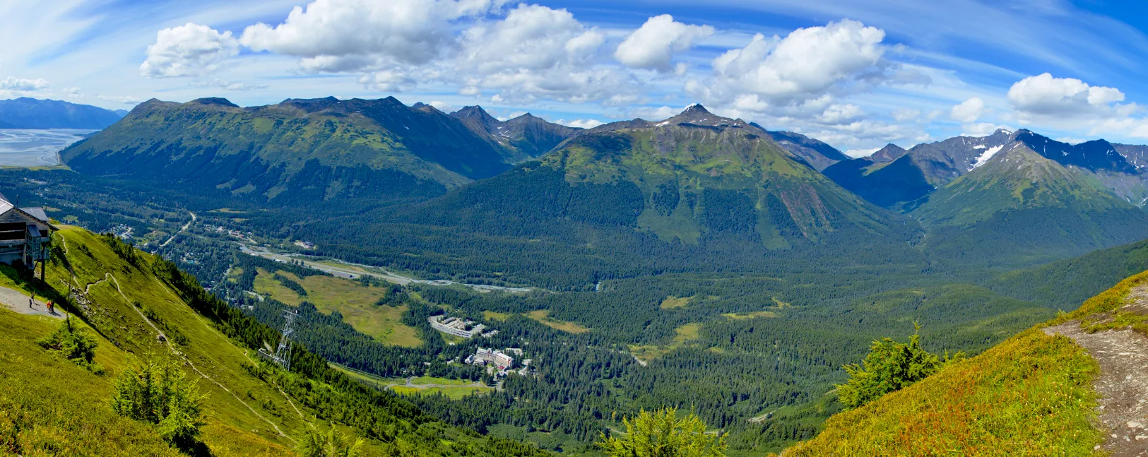
Girdwood is built into a narrow valley surrounded by dense forest, with homes and businesses sitting directly against wildland on nearly every side. This kind of setting is known as the wildland-urban interface, and is exactly where wildfires spread fastest and are hardest to contain, especially during dry, windy stretches in summer.
The valley’s geography adds another layer of risk: Girdwood is connected to the rest of Anchorage by a single road, the Seward Highway. If a wildfire threatens that corridor, it can affect not just homes but the community’s only way in or out. That combination of high fuel loads, limited egress, and a relatively small, spread-out population is why having a clear, practiced evacuation plan isn’t optional for Girdwood households. It’s essential.
Ready, Set, Go: Understanding Evacuation Levels
During a wildfire, GFR uses the Ready, Set, Go system – now a standardized evacuation scale used across Alaska – to communicate risk clearly to residents and to travelers passing through who may not be familiar with local terms.
- Ready: A fire is burning in the area. There is no immediate threat to your home, but now is the time to prepare: review your evacuation plan, pack a go-bag, and stay tuned to local alerts.
- Set: Conditions have changed, and a fire is close enough that you should be ready to leave at a moment’s notice. Pack your vehicle, account for family members and pets, and stay alert for further instructions.
- Go: Leave immediately. Do not wait to gather belongings or wait for confirmation – go now, using the route directed by emergency responders.
For a printable reference covering Ready, Set Go, the 5 P’s of Evacuation, defensible space steps, and the Statewide Wildfire Evacuation Map, download the Wildfire Evacuations Brochure, produced by the Alaska Division of Forestry and Fire Protection.
Evacuation Routes
Because Girdwood has only one road connecting it to Anchorage, the Seward Highway (accessed via the Alyeska Highway) serves as the primary evacuation route in almost every scenario. During a declared emergency, the Fire Chief and emergency responders coordinate traffic control along this corridor to keep routes open and manage congestion.
Because of this single-corridor layout, GFR strongly encourages residents not to wait until the last minute to leave during a “Set” level alert. Once a “Go” order is issued, traffic volume on the highway can slow evacuation significantly. For current evacuation routes and active fire locations statewide, check the Alaska Statewide Wildfire Evacuation Map.
Coordination & Assembly
In a wildfire emergency, GFR works directly with the Municipality of Anchorage, Alaska State Troopers, and Alaska Division of Forestry to manage response and evacuation logistics. Specific assembly points and shelter locations are determined based on the nature and location of the incident and will be communicated through official alert channels at the time of an event.
Stay Informed & Prepared
The best evacuation plan is the one you make before you need it.
Sign up for Anchorage Emergency Alerts now: Text ANCHORAGE to 67283, or visit muni.org/Smart911 to register. This is how official Ready, Set, Go notifications reach you the moment they’re issued.
A few more steps every household in the valley should take:
- Request a free Firewise Home Assessment through the Anchorage Fire Department’s Wildfire Program to identify risks around your property.
- Create defensible space around your home by clearing brush and flammable debris.
- Check 511.alaska.gov for current road conditions and closures along the Seward Highway.
- Build a family evacuation plan and go-bag in advance, so you’re not starting from scratch during a “Set” or “Go” alert.
For emergencies, always call 911 first. For general questions about GFR’s wildfire preparedness program, contact us at (907) 783-2511 or fire@girdwoodfire.com.